


Voting District 0814282002017, Kent County, Michigan
About
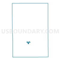
Outline

Summary
| Unique Area Identifier | 597438 |
| Name | Voting District 0814282002017 |
| County | Kent County |
| State | Michigan |
| Area (square miles) | 1.31 |
| Land Area (square miles) | 1.31 |
| Water Area (square miles) | 0.00 |
| % of Land Area | 100.00 |
| % of Water Area | 0.00 |
| Latitude of the Internal Point | 42.91076570 |
| Longtitude of the Internal Point | -85.57374040 |
Maps

Graphs
Select a template below for downloading or customizing gragh for Voting District 0814282002017, Kent County, Michigan


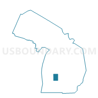
Neighbors
Neighoring Voting District (by Name) Neighboring Voting District on the Map
- Voting District 0811366000004, Kent County, MI
- Voting District 0813400003004, Kent County, MI
- Voting District 0813400003053, Kent County, MI
- Voting District 0813400003054, Kent County, MI
- Voting District 0814282002012, Kent County, MI
- Voting District 0814282002013, Kent County, MI
- Voting District 0814282002014, Kent County, MI
- Voting District 0814282002016, Kent County, MI
Top 10 Neighboring County Subdivision (by Population) Neighboring County Subdivision on the Map
- Grand Rapids city, Kent County, MI (188,040)
- Kentwood city, Kent County, MI (48,707)
- Cascade charter township, Kent County, MI (17,134)
Top 10 Neighboring Place (by Population) Neighboring Place on the Map
Top 10 Neighboring Unified School District (by Population) Neighboring Unified School District on the Map
- Grand Rapids Public Schools, MI (182,019)
- Kentwood Public Schools, MI (61,913)
- Forest Hills Public Schools, MI (46,642)
Top 10 Neighboring State Legislative District Lower Chamber (by Population) Neighboring State Legislative District Lower Chamber on the Map
Top 10 Neighboring State Legislative District Upper Chamber (by Population) Neighboring State Legislative District Upper Chamber on the Map
Top 10 Neighboring 111th Congressional District (by Population) Neighboring 111th Congressional District on the Map
Top 10 Neighboring Census Tract (by Population) Neighboring Census Tract on the Map
- Census Tract 44, Kent County, MI (7,550)
- Census Tract 126.07, Kent County, MI (5,299)
- Census Tract 126.06, Kent County, MI (5,256)
- Census Tract 122.03, Kent County, MI (4,217)
- Census Tract 126.08, Kent County, MI (3,094)